GPS Control Survey
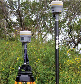
A GPS (Global Positioning System) control survey utilizes high precision survey grade Global Positioning Receivers to establish horizontal and vertical values for remote locations. Measurements can be determined without the necessity of a clear line of sight between points on the ground which enables the surveyor to work in extraordinary terrain and to cover large areas in an efficient and precise manner. GPS equipment is sometimes used to gather vertical and horizontal positions of existing features including, but not limited to, boundaries, improvements, topography and planned locations for construction.